National Consortium for Remote Sensing for Transportation
The intent of this multi-year research project is to develop and validate Commercial Remote Sensing (CRS) applications that can enhance current bridge management systems (BMS).
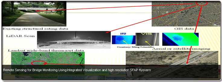
As part of the research, a prototype Integrated Remote Sensing and Visualization (IRSV) system has been developed. IRSV can serve as a remote sensing data management and decision-making tool. A longer-range objective is to enable the IRSV components to be integrated into PONTIS and other state and local BMS applications. IRSV contains a high resolution visual database using, in part, on-site bridge inspection data.
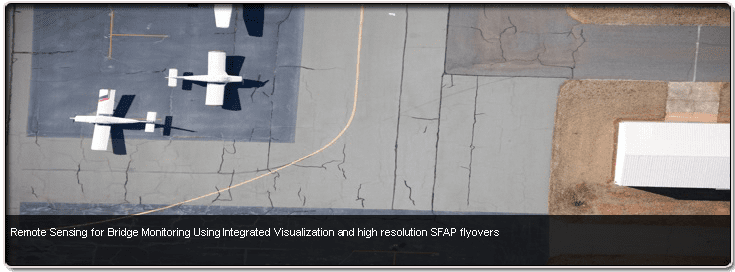
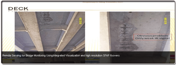
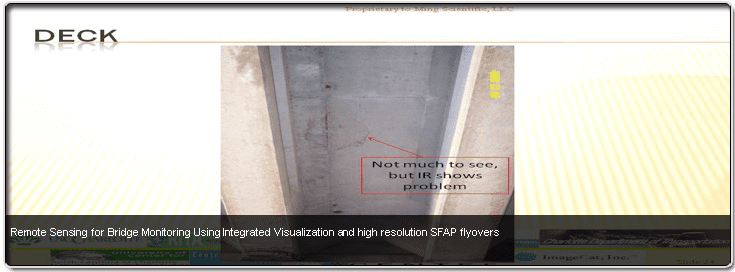
Additional data that is not included in semi-annual bridge inspections includes LiDAR imaging, sub-inch aerial photography, and Infrared images. Partners in this first phase research project have included the City of Charlotte DOT and the North Carolina DOT.
The multi-disciplinary research team includes the UNC Charlotte Center for Transportation Policy Studies (lead), the Charlotte Visualization Center, ImageCat, Inc., Boyle Consulting Engineers PLLC, and Dr. C. Michael Walton, P.E. This project is supported by a Cooperative Agreement with the U.S. Department of Transportation, Research and Innovative Technology Administration.